The word staithe appears to be unique to Norfolk. It comes from the Old Norse word Stoth meaning “landing stage” for unloading boats.
Martham has three staithes which do not appear on Faden’s map of 1797 which details low-lying land in the parish beside the river as undrained fen. Therefore it seems the staithes were constructed after that time.
The earliest record for them is their appearance in the 1812 Inclosure Award for Martham. They are described as:
- Parcel number 6 which we now know as Martham Boat Dyke.
- Parcel number 10 which is at the north end of Cess Road.
- Parcel number 12 which is near Dungeon Corner north of Damgate.
Martham Boat Dyke (sometimes known as Ferrygate Staithe).
The Boat Dyke was described as Parcel No 6 in the 1812 Inclosure Award and as being “for the conveyance of corn, manure and other goods to and from the river by owners and occupiers of the Parish.” The award also allocated a broad strip of land running along its west side (plot No11) to the ‘Special Commissioners for the Public Staithe’ and both were described as a boat dyke and staithe which were owned and occupied by the Commissioners of Drainage.

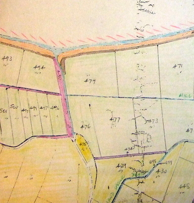
The 1842 Tithe Award map, above, shows the staithe as plot number 480 which is described as a boat dyke and staithe which was owned and occupied by the Commissioners of Drainage. The Finance Act map and documents of 1910 also give the Drainage Commissioners as owners.
Generally referred to as Martham Boat Dyke it is managed by the Martham Boat Dyke Trust under the auspices of Martham Parish Council. The Trust gets its income from letting out the mooring rights and its object is the maintenance of the staithe and to give charitable grants for the benefit of the inhabitants of the Parish.

Cess Staithe
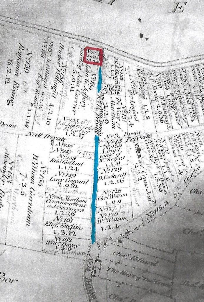
Cess Staithe was described as Parcel 10 in the 1812 Inclosure Award off the River Thurne and at the time was allotted to the Special Commissioners for Public Staithes, approached by a private road No14 which was likewise allocated to them. The Act explicitly made clear it was for the use and convenience “by the Owners and Occupiers of Estates within the said Parish of Martham for the time being, for the laying and depositing theron of the corn, manure and other things which shall be conveyed or shall be intended to be conveyed by the said River or to and from the said river by means of the said Boat dyke or Dykes” (1).
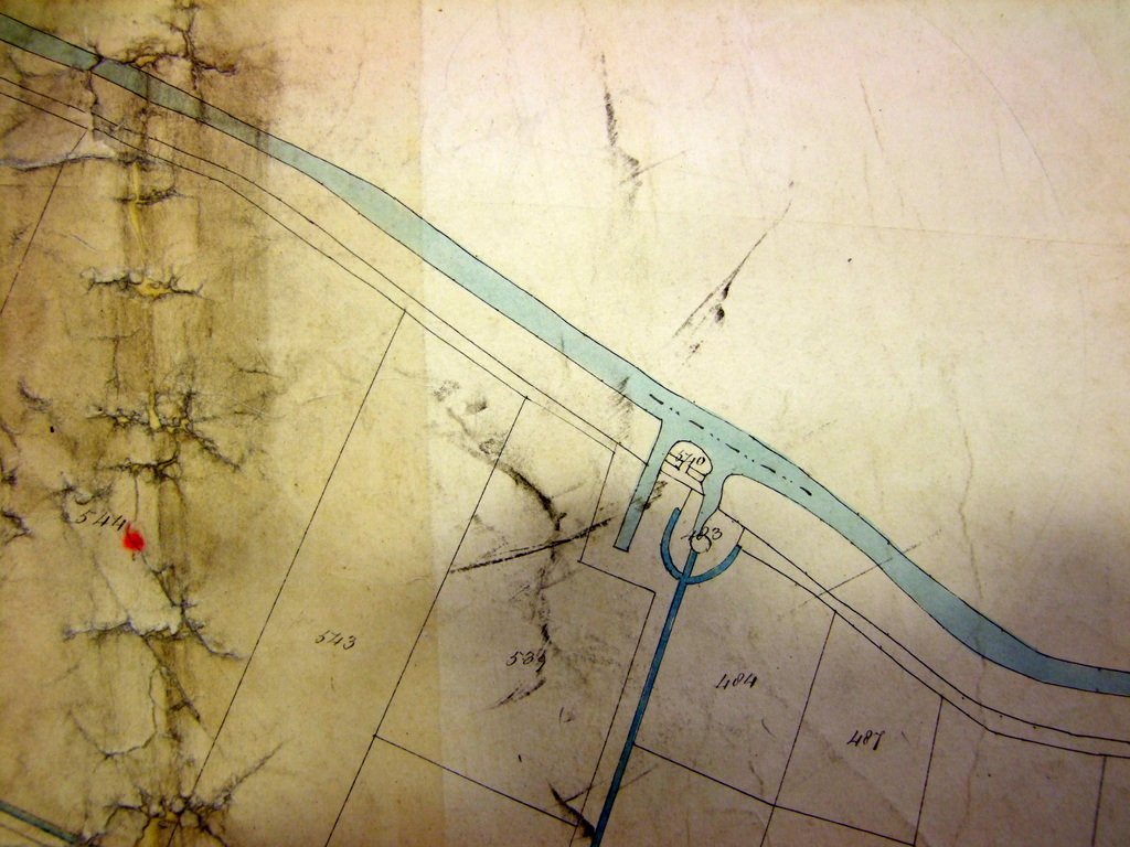
On the 1842 Tithe Award map, above, the Staithe is shown as next to two plots of land Nos 540 & 483, both owned and occupied by the Drainage Commissioners. Plot 540 was described as a “boat house”, whilst 483 as a “mill & yard”. The purpose of the Tithe Award was to identify taxable properties so the list did not actually list the staithe itself. The 1910 Finance Act maps and documents likewise give the Drainage Commissioners as owners.
Cess Staithe was the subject of an adverse possession case in 2013, which was won by the occupiers, the Martham Boat Building and Development Company Ltd, which had been using and developing the area since the 1940s. The evidence suggested that Cess Staithe should belong to the Environment Agency, having presumably passed in the 1930s from the Drainage Commissioners to the East Norfolk Rivers Catchment Board and then in 1948 to the East Suffolk and Norfolk Rivers Board and in 1966 passed via the Anglian Water Authority and the National Rivers Authority to the Environment Agency. None of the Agencies were deemed to have maintained the staithe and the Tribunal Inspector confirmed it was in the private ownership of the Boat Building and Development Company.
Damgate Staithe
Damgate Staithe is owned by Martham Boat Dyke Trust and the title is registered at the Land Registry.
The Staithe is described as Parcel number 12 in the 1812 Inclosure Award and as a small inlet from the river, at TG 45270 20320. It is described as a public staithe for the use of owners and occupiers of land in Martham and was allotted to the ‘Special Commissioners for the Public Staithe’.
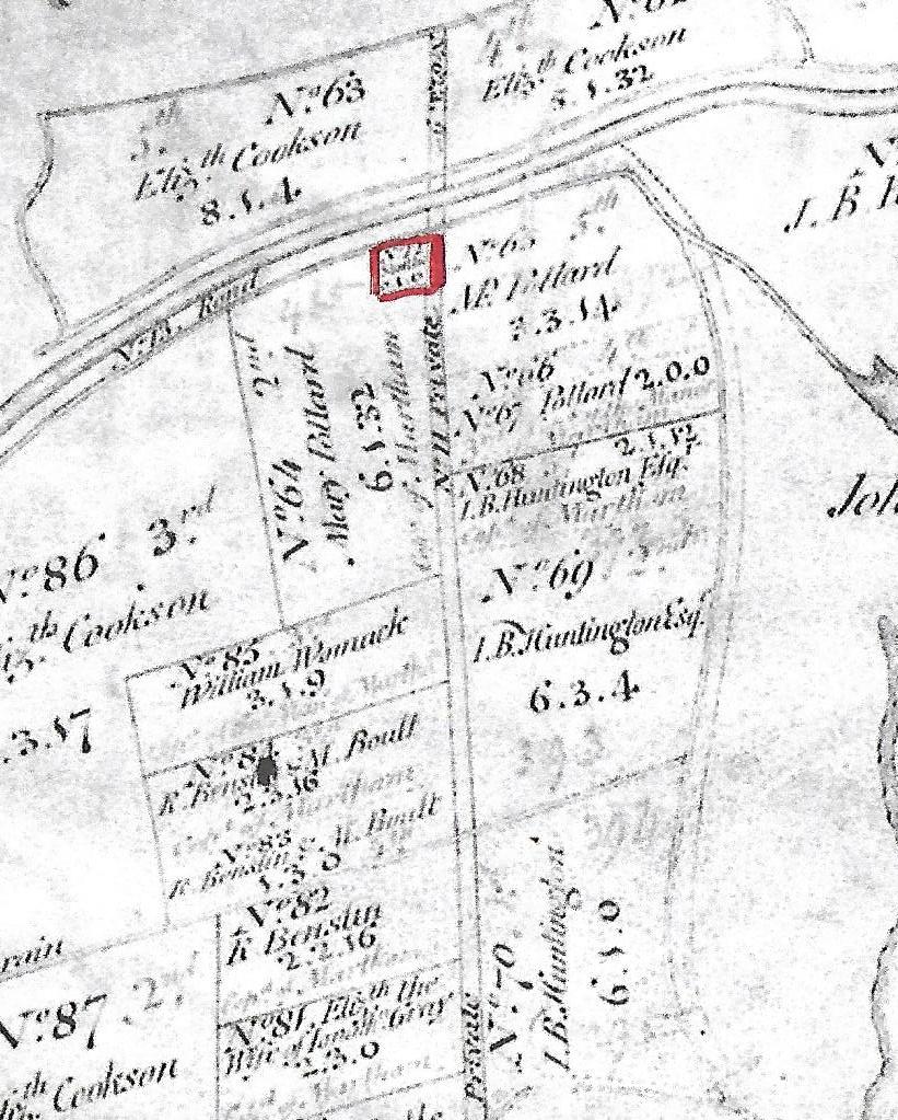
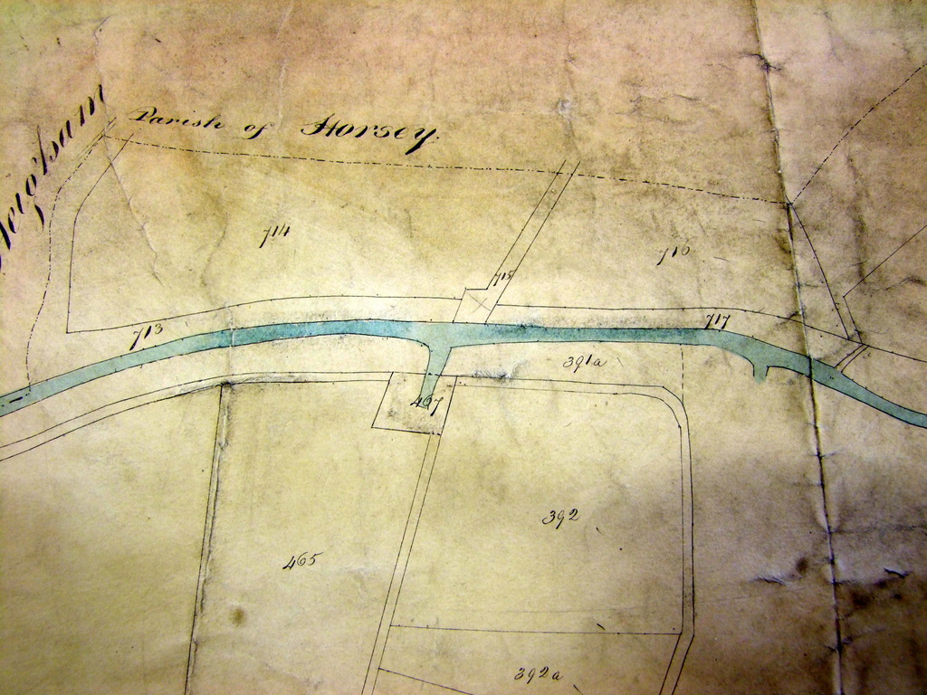
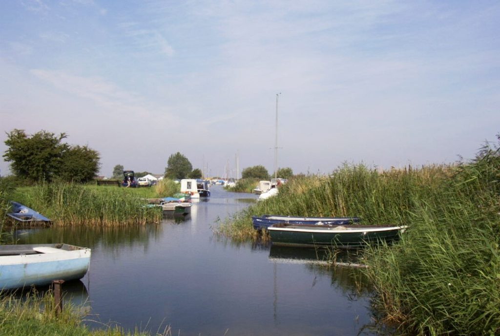
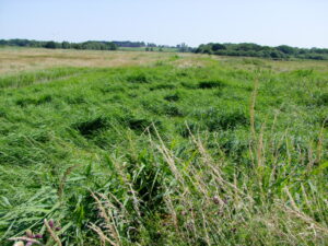
On the 1842 Tithe Award map it is shown as plot 467 approached by a private road number 466. Both were owned and occupied by the Drainage Commissioners. It is accessible from the north end of Damgate via what is now known as Footpath No25 which you can read about by clicking on the link to Footpaths. Alternative access is via Ferrygate Boat Dyke, the riverbank and definitive Footpath No2. Sadly the boat dyke is now silted up and you will need a keen eye to spot it. The only way to identify the site is by the lush green undergrowth as shown in the foreground of the photo below.
You may also like to read the following complimentary pages: Heigham Holmes, Martham Ferry, River Thurne & Martham Broad.
My thanks to the Broads Authority for some of the information supplied above.
(1) An Act for Inclosing and Draining certain Lands in the Parish of Martham in the County of Norfolk. [25th April 1807.]. Page 623.
Photographs
Use your mouse to hover over an image to see a description. Click on an image to enlarge it and you can then scroll through the rest.


