Martham has many ponds and this page introduces you to the ones I am aware of. If you know of others, or can add information about those featured, please contact me.
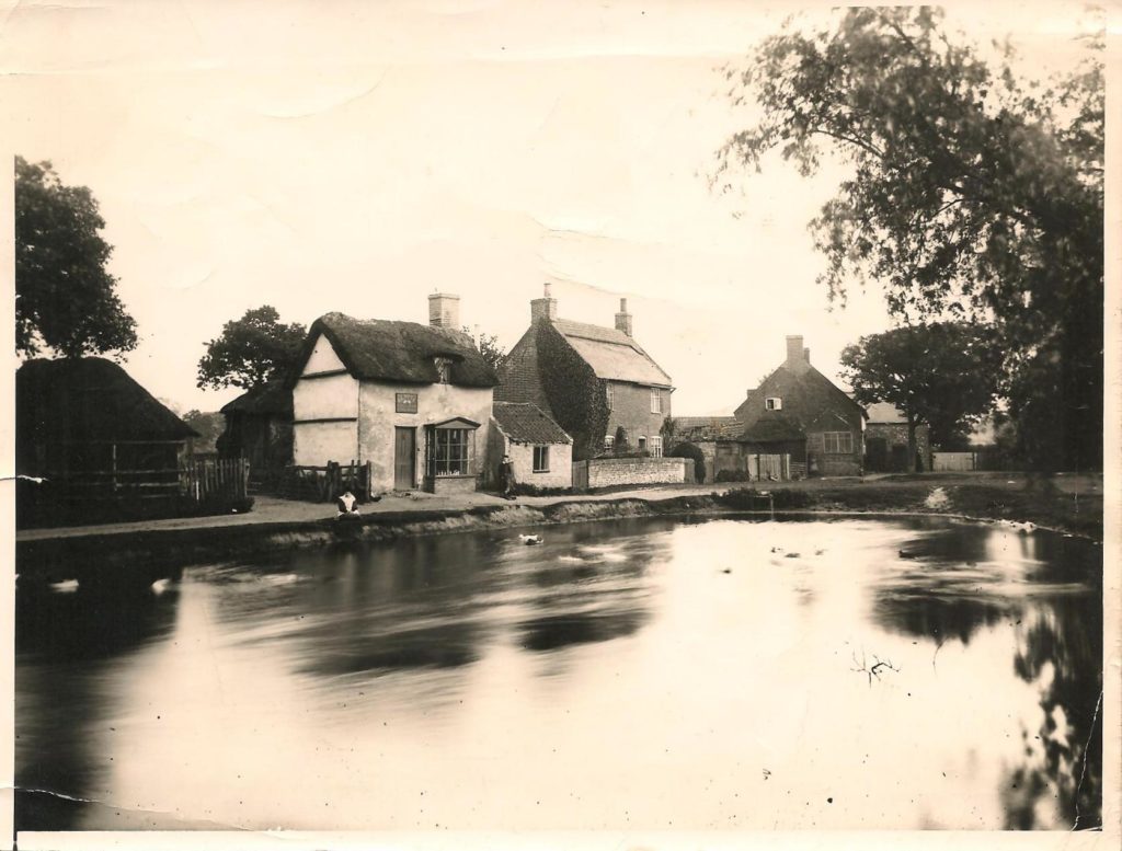
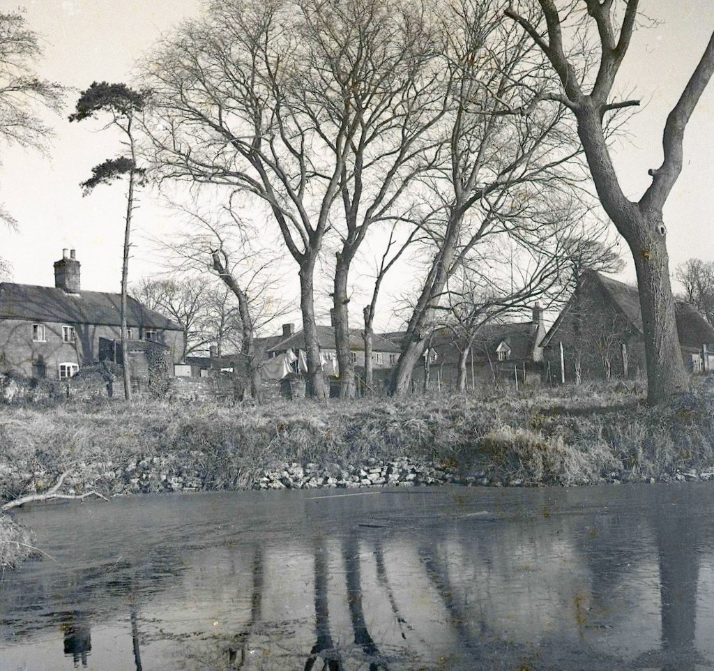
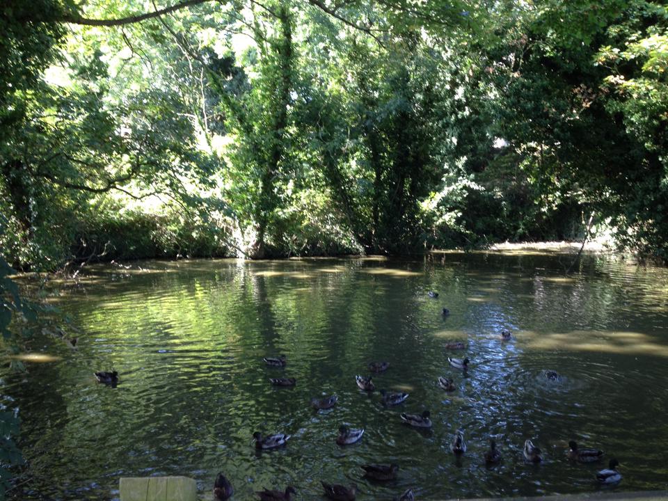
The Twin Ponds
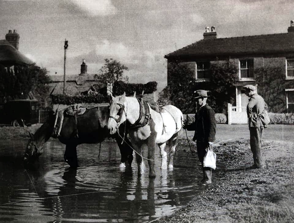
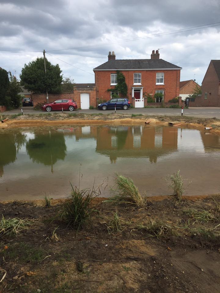
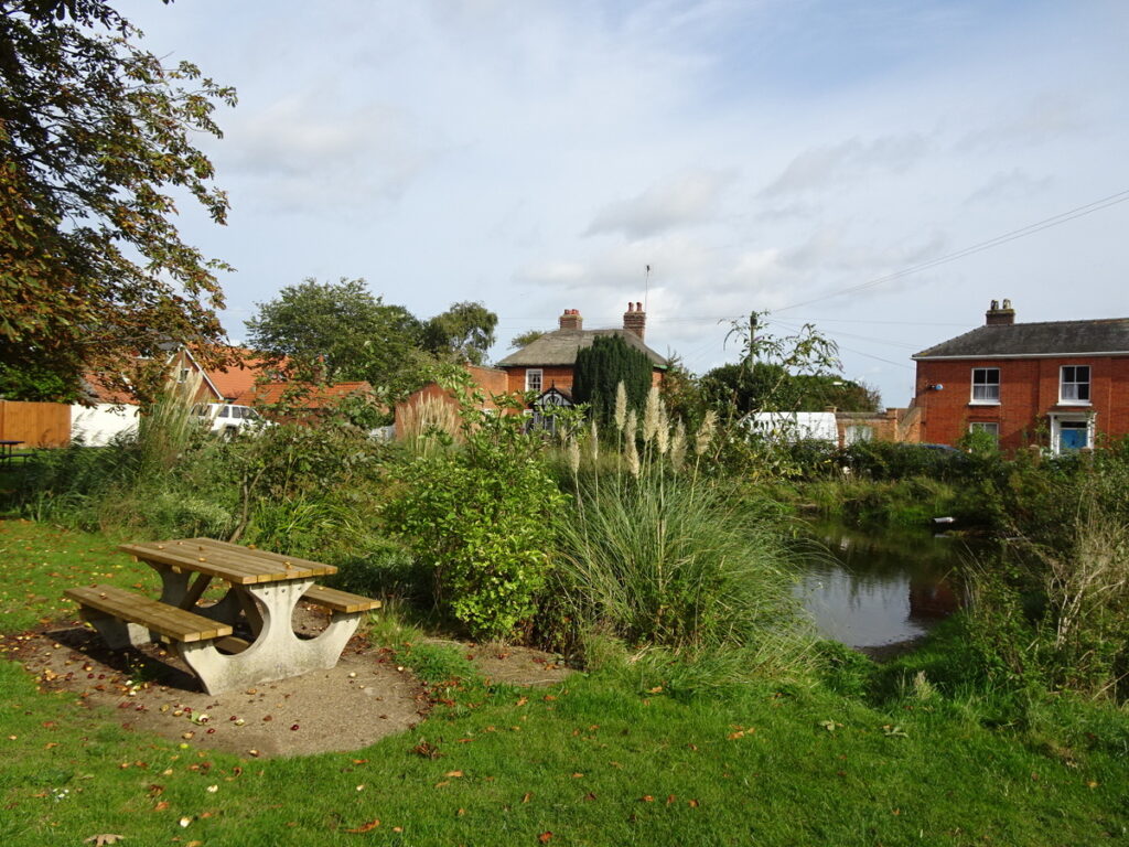
These are, or were, the two main ponds in the village centre. The one opposite the King’s Arms (sometimes called Chapman’s Pond ) is still there; its twin was on Cranes Green just in front of the Co-op on The Green. Local people sometimes call the main pond “The Pit” and in 1871 James Braddock, who was a thatcher, lived where Chapman’s Butchers is now and called his home Pit Farm which was a reference to the main pond.
I published a series of articles in the Parish Magazine about these ponds some years ago but you can read the whole story by clicking HERE.
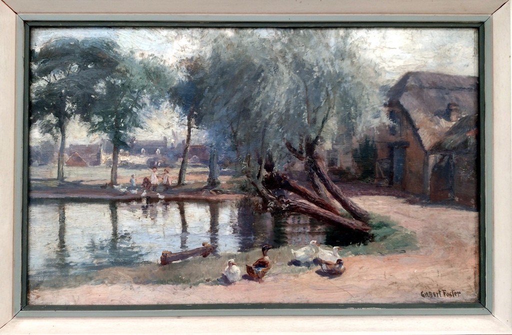
There is a special album of photographs of the twin ponds below.
Copy provided courtesy of Mrs M Gordon.
Bell Meadow Pond
This pond is at the end of the more modern development called Kirby Close but the pond is in what was Bell Meadow just over the graveyard wall. The above photo shows Bell Yard Cottages and the former Martham House barn on the right. It is said that this pond and the one across the road that was in the grounds of Martham House are joined by an underground spring which may be why the road in front of The Lodge collapses sometimes. The pond appears on the 1881 OS map. Do you know anything else about this pond? If so please contact me.
Black Street Pond
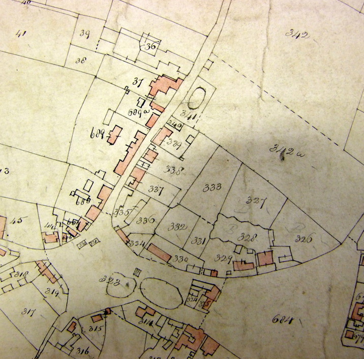
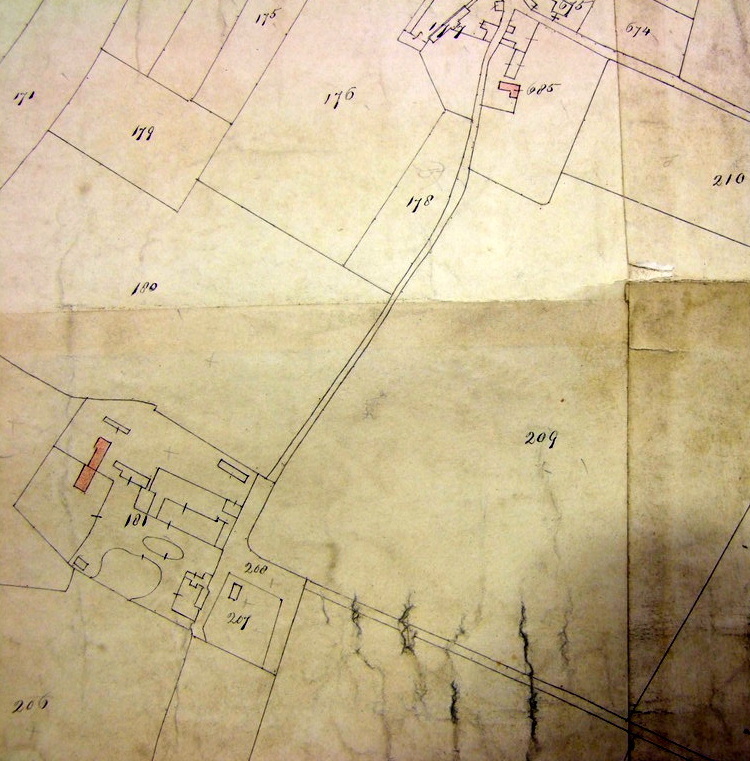
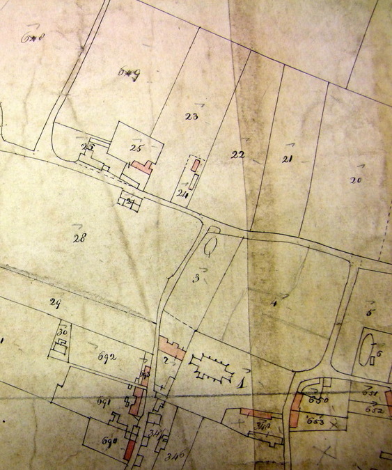
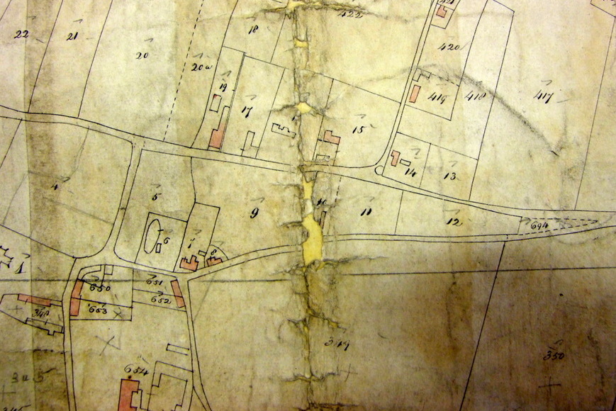
Once upon a time there was an ancient pond to the east side of Black Street. It is shown on the 1842 Martham Tithe Award map illustrated below within plot No341 which at that time was owned by Anne Purdy, nee Rising, (1777-1844). She lived opposite at Grove Cottage on the west side of Black Street – shown as plot 37 on the map. She was the wealthy widow of Robins Purdy who died earlier in 1842 and she owned just over 120 acres of land and property in the village.
Many, many years later the pond was in the garden of The Limes where John Larter a plumber and decorator lived in 1939. I am told the pond was filled in to provide a garden of sufficient size when a new bungalow was built next door to The Limes.
Bracey’s Pond
Bracey’s pond (or Back Lane pond), stands just off Back Lane next to the Fish & Chip Shop and has proved popular for many years with visitors who enjoy their chips on the picnic table provided by the Parish Council. As the pond is on the Village Green it is owned by the Council. It is an old pond and appears on the 1842 Tithe Award map. Traditionally used to cool off horses after a long day working on the farm it tended to dry up in the 2000’s. In the past it was kept full by run-off water from Bracey’s Blackcurrant Farm and also from road drainage some of which is known to have come across under The Green from road drains over near the Baptist Church but they fractured over the years and leaked most of the water before could reach the pond. In its heyday it even over filled and has an overflow drain in the corner of the Back Lane side that takes surplus water all the way down Hall Road to the treatment works. The lack of water meant it was not looking its best for many years. In around 2011 the Parish Council tried to solve the problem by making provision to top it up from the mains but this proved prohibitively expenses and did not solve the problem caused not only by the lack of water flowing into it but also by the base leaking. In 2018 the Council took more dramatic action to improve it by adding a liner, repairing surround walls and providing new plants around the edge, the result is that the pond has become a healthy natural habitat.
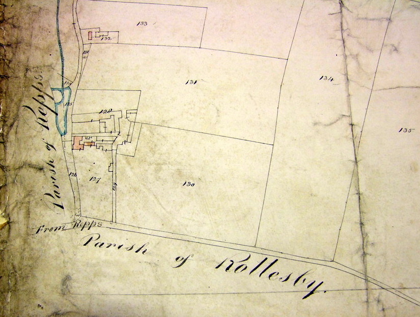
Martham Hall Ponds
The Lord of the Manor owned Martham Hall and the above 1842 Tithe Award map shows not one but two ponds near the house in Hall Road. If you know more about these ponds please let me know.
Martham House Pond

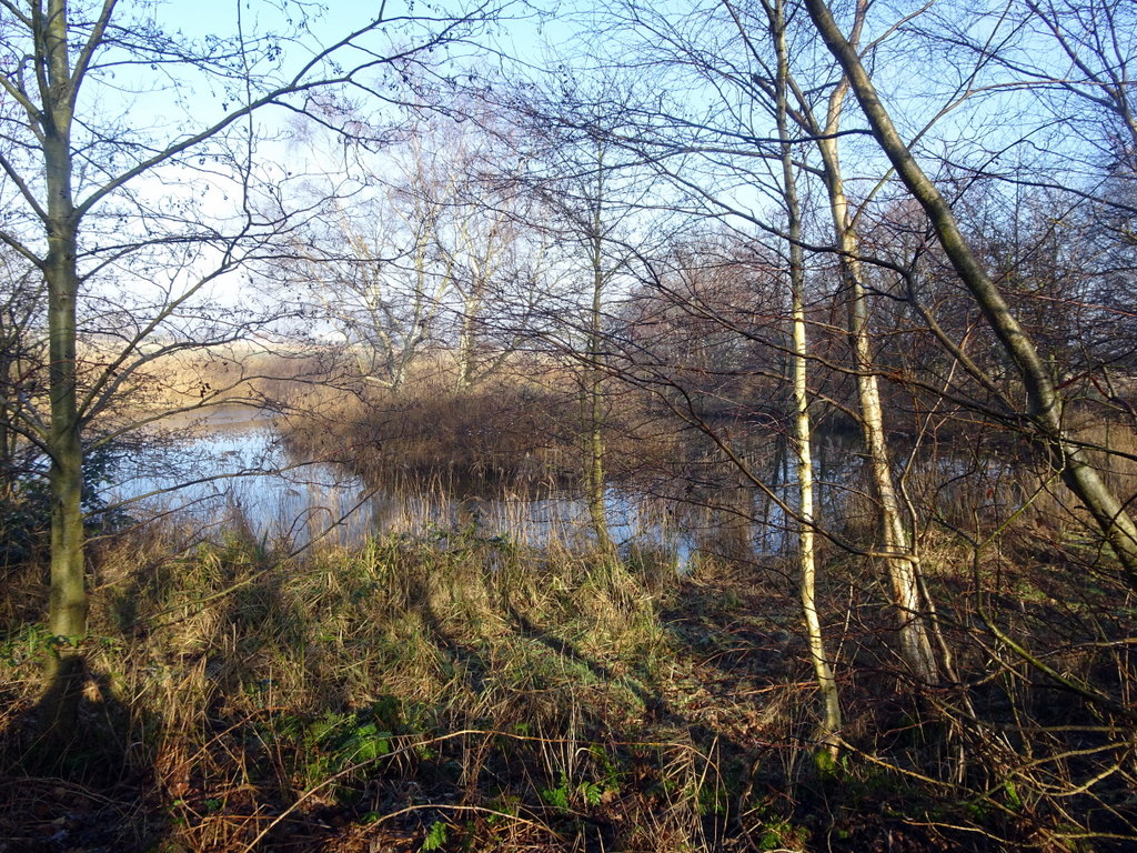
Once part of the ornate gardens of Martham House this horseshoe shaped pond stood in beautiful gardens in the mid 19th century before the house fell into ruins. The pond is still there today as part of the garden of a house on Somerton Road but is now kept more as a conservation area surrounded by large trees as you can see from the above photo. You can read more about the association this pond had with Martham House by clicking HERE.
Moregrove Pond
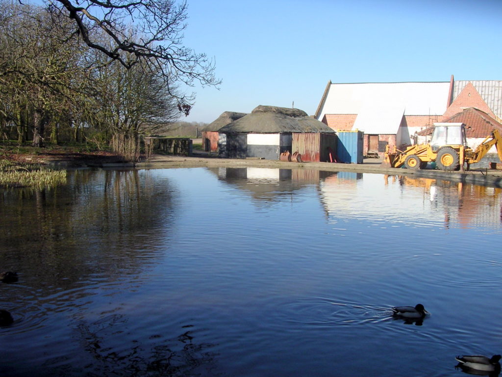
This beautiful traditional farm pond sits in the second medieval manor of Martham at Moregrove. It would have been in front of the long since gone Moregrove Hall and may have connected with a small moat that surrounded part of the house. When the owner, Jeremy Moore, set about modernising the old barns he found several parts of the stone masonry from the manor house discarded in the pond.
Mustard Hyrn Pond, Cess, Martham
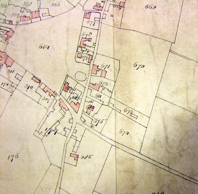
This little known pond can be found in the corner formed by the Private Road at the north end of Cess Road and Private Road/Track No15 created by the 1812 Martham Inclosure Award as shown on the map below. Find it at map reference TG44057 18903, easting 644057, northing 318903.
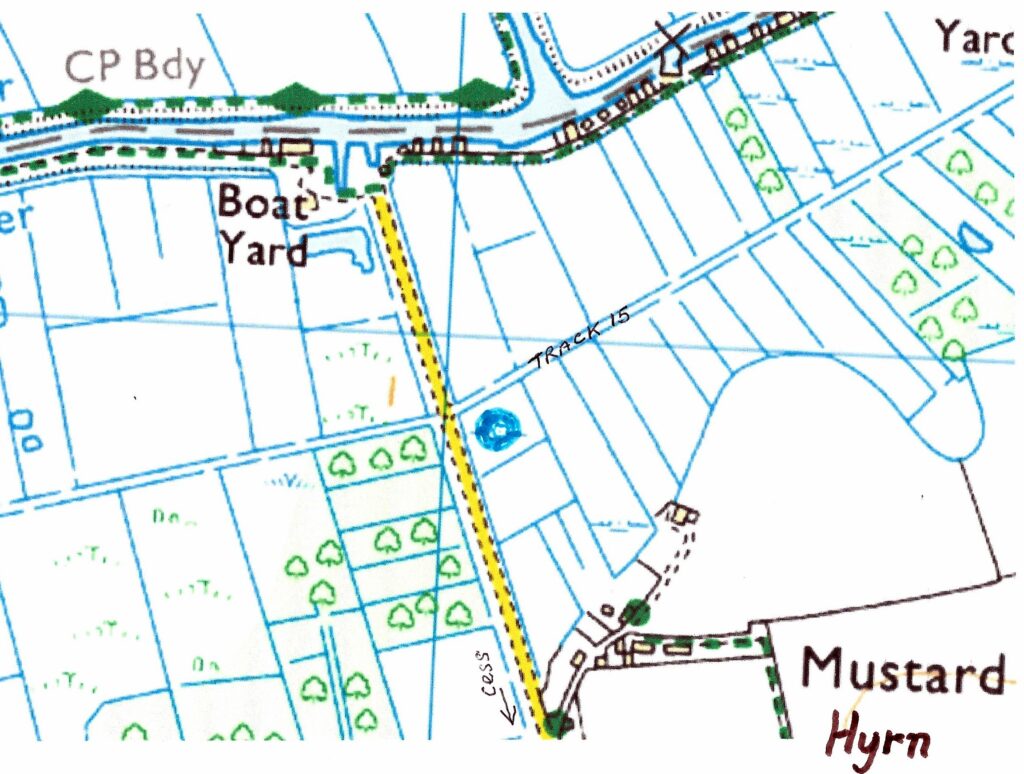
The pond is doughnut shape and is probably relatively new as it does not appear on any maps up to and including the 1906 OS map. It was probably formed in a natural dip and filled from the surrounding drainage ditches but has since had its sides raised in height perhaps to keep it for sporting purposes. It is delightfully isolated and an environmental gem.
If you know anything more about the pond, please contact me.
Porter’s Pit
This was a small pond at the north end of Black Street at its junction with Staithe Road. It was quite an old pond because it is shown on the 1842 Tithe Award Map. It is believed to have been filled in during the 1970’s as part of drainage improvements possibly when the new bungalows were built nearby. Brian Buck (1929-1997) did some of the work.
Smee 3, Grange Farm pond
This pond is north of The Grange along Common Road but is within Smee No3 which is an inaccessible semi-bog retained nowadays by the farmer as a wild life area. Don’t go in it. It is overgrown and possibly dangerous. It is shown as plot No125 on the 1842 Tithe Award map. You can read more about the Smees by clicking HERE.
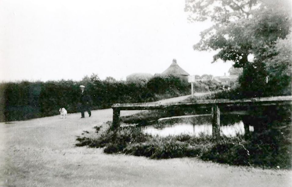
School Road Pond
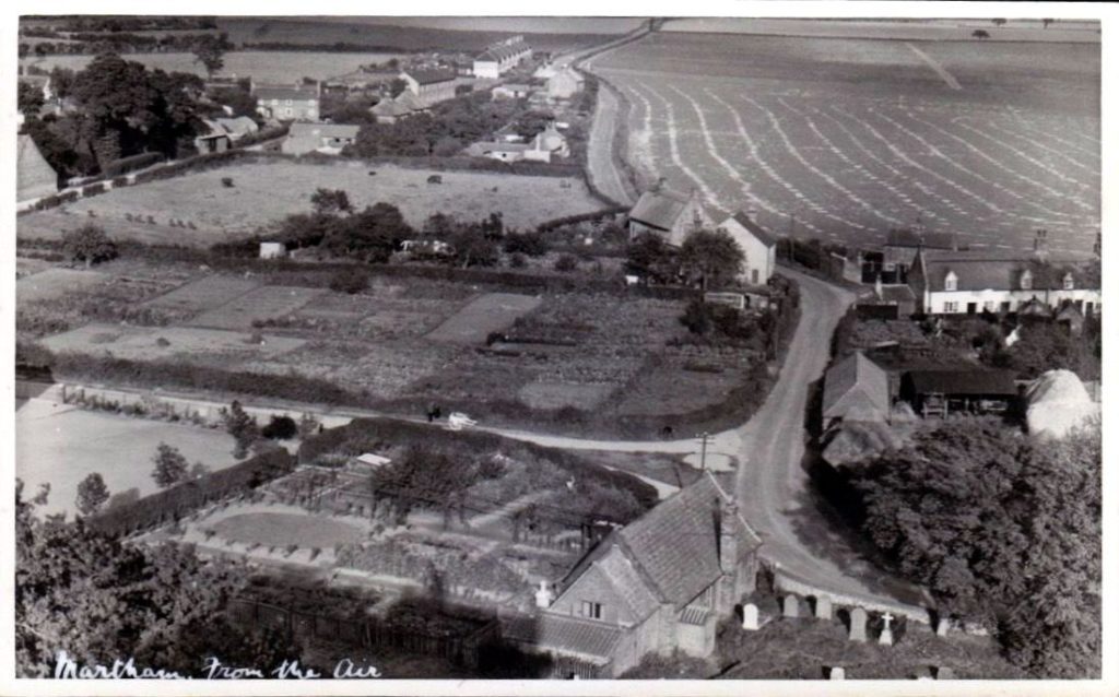
Before the 1970’s the east side of School Road was allotments on land owned by the Church. At that time there was also a pond there towards the Somerton Road end of the site. It is shown on the 1842 Tithe Award map as plot No6. All this was, of course, long before the four detached house and bungalows were built there. The above photo from the 1930’s shows the allotments but no pond. Perhaps it had been filled in to provide more plots! Does anyone have a photo of the pond please?
White Street Pond
This pond was at the south end of Martham House garden roughly where 44 White Street is now. I cannot find any other record of it and it is not on the 1881 OS map so may have been small and shallow. It is claimed that it was drained and filled in with bricks when the five new houses were built along the frontage of the former Martham House.
Photographs
There are two albums of photographs. The first is photos of the twin ponds and the second is general photos of other village ponds.
Click a thumbnail for a close-up and scroll through all the images from there.


