Footpath No2, Martham 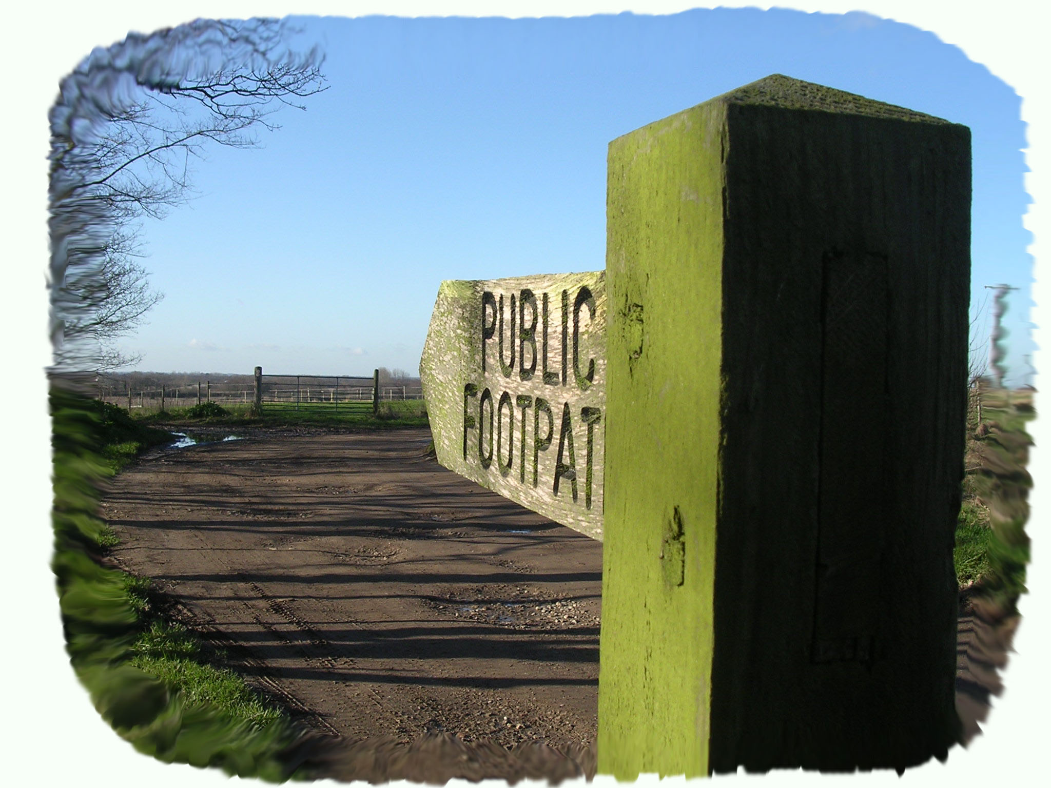
Footpath No2: Runs from Ferrygate Boat Dyke Staithe, round Martham Broad and on to Somerton.
OS map ref: TG448192 to TG467200. Distance: Just over 2 miles
Surface: Narrow dirt footpath, can be muddy and slippery in wet weather. Watch out for root trip hazards on this remote path.
Description: Peaceful Broadland views across the River Thurne and Martham Broad.
Linked Footpaths: No1, Cess Road Boat Yard to the Boat Dyke Staithe at Ferrygate Lane.
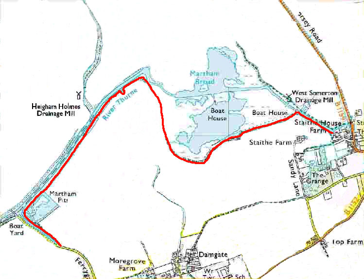
Start: Leave the village via Black Street and Ferrygate Lane. Descend the slight hill of Ferrygate Lane in a northerly direction with fine views across Broadland including Hickling Broad and on a clear day even Happisburgh Lighthouse on the horizon.
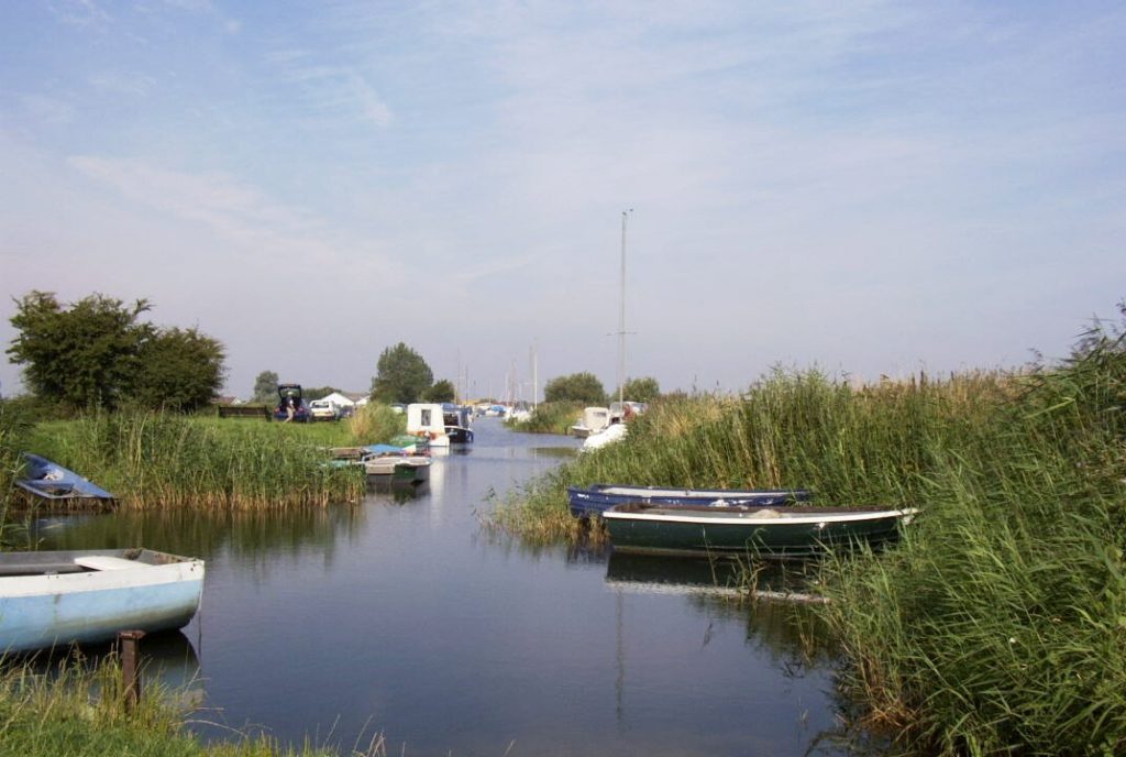
Park at the head of The Staithe (TG448212) and with your back to the village (see photo left) take the path to the right hand side of the Staithe past the moored boats for 350 yards (323 metres) until it turns east when you come to the River Thurne. See the notes for Footpath No1 about the swing bridge at the mouth of the Staithe.
Immediately to your right is Martham Pits. These small fishing pools or lakes were created after clay was extracted and used to make the familiar “Norfolk Red” bricks that can be seen in many of the older houses in the village. Wherries that used to come to Martham Staithe would bring coal and timber and travel back with corn or the red bricks.
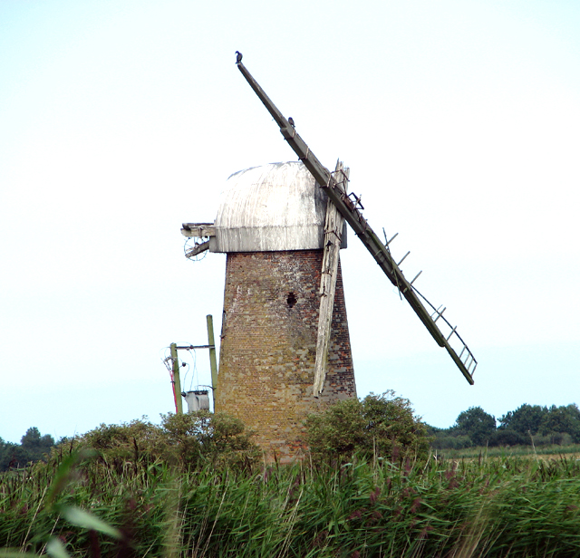
Continue past the pits heading east and in the distance there is Somerton and the sand dunes on the coast but for now you go on and you pass the defunct Heigham Holmes Drainage Mill (shown right) on the other side of the river. After about for 1,100 yards (1019 metres) the path leads you a few steps away from the river at what was once the third Staithe of Martham.
If you are watching the river or abundant wildlife you may almost miss this little filled in outline of a cut almost invisible to the eye but here was once the small Staithe serving a lane up to the hamlet of Damgate. This was formed as a result of the Inclosure Act of 1807 when an “Act for Inclosing and Draining certain Lands in the Parish of Martham in the County of Norfolk” was passed. All the Martham Staithes were said to be “for the depositing thereon of the corn, manure and other things which shall be conveyed…by the said river”. From here to the north side of the river you are looking at Heigham Holmes, a vast track of deserted marsh and broad managed by the National Trust and perhaps one of the remotest wildlife havens in Great Britain.
It is not unusual to see flocks of geese flying overhead here or feeding on adjacent fields. You may also spot marsh harriers as they fly up several hundred feet before diving, sometimes somersaulting downwards, then swooping upwards again near the ground. The male will often pass the female food during these displays.
The path turns south at what is known as Dungeon Corner (from the old English ‘Dunsyn’ meaning water-logged land invaded by scrub) to skirt Martham Broad. The river actually flows through the centre of the Broad but it is a protected wildlife area and mooring is not allowed. Martham Broad, like many others, was formed following thirteenth century peat cutting which was the local source of fuel until disaster struck in 1287 when a sea surge through the sand dunes north of Horsey flooded the peat diggings at Hickling, Horsey and the north-east corner of Martham making further work in these areas impossible. On the edge of the Broad vegetation grows each side of the path where trees of birch, pussy willow, elder, alder and oak have sprung up.
Martham Broad is a National Nature Reserve located about 2km north of the village. The reserve is owned and managed by the Norfolk Wildlife Trust and is part of the Upper Thurne Broads and Marshes Site of Special Scientific Interest. It comprises 590,000 m2 of open water, reed and saw-sedge fen and is a shallow brackish lake. The reed swamp consists of common reed and lesser reedmace. In summer the Swallowtail butterfly can be seen. Boats can only use a narrow-marked channel through the broad.
The final part of the walk takes you over Martham Parish boundary and along the riverbank past Staithe Farm, into the village of Somerton. From here it is possible to turn into Sandy Lane, Somerton and join Footpath No 3 back to Martham to complete a splendid circular walk. You may like a bit of a break however, by taking the main highway for a few hundred yards through Somerton to the Lion PH for both drink and food refreshment.
For a printer friendly version click HERE. This will open a separate window as a ‘pdf’ that you can then print.