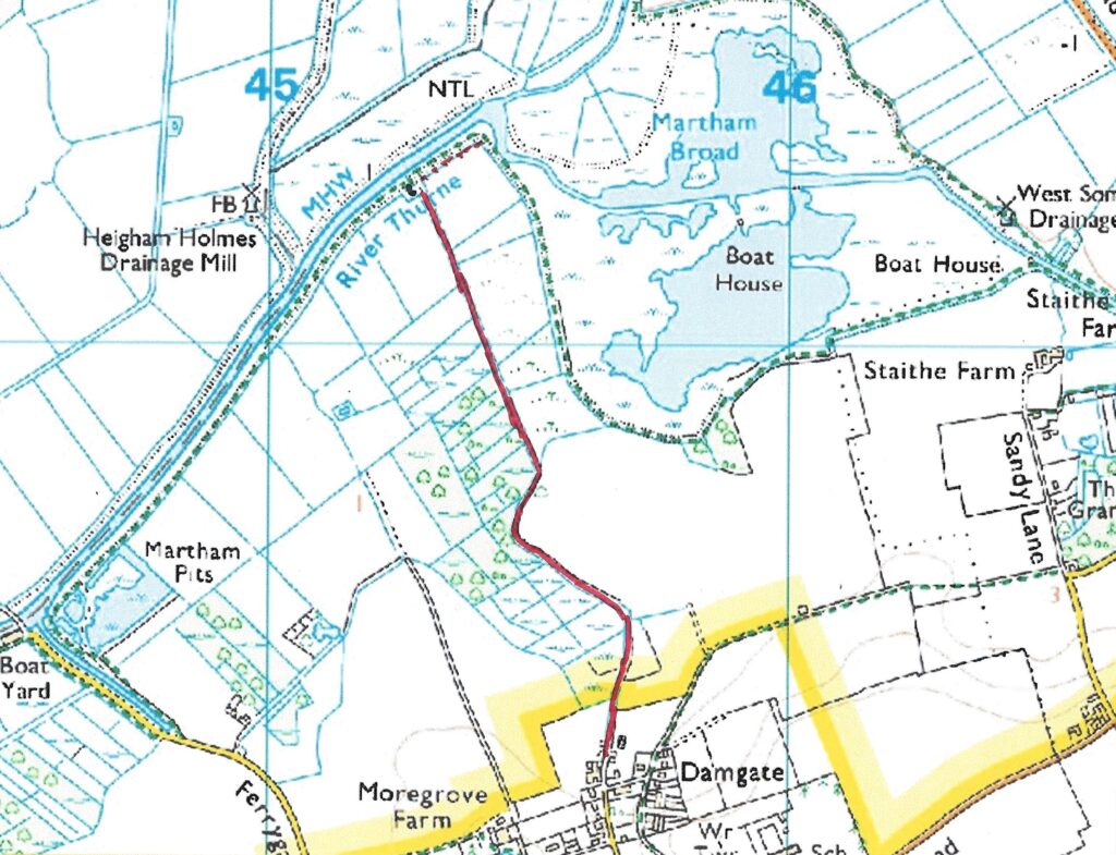
Footpath No25, Martham 
This footpaths runs from Damgate to the River Thurne near Dungeon Corner.
OS map ref: TG4565 1922 to TG4528 2030. Distance: 2751 yards (2516 metres)
Surface: Flat walk but with uneven, bumpy sections towards the north end.
Description: If you like to get away from it all this is the walk for you. Truly back to nature and tranquility and yet this route was once a highway in the19th century and probably a medieval one long before that. It provides a visual commentary of Broadland succession stages from original reedy marsh, waterlogged wooded terrain, Alder Carr growth and eventual dry shrub and trees plus big Norfolk skies and river views.
Linked Footpaths: Links to Footpath No2 and nearby No4 for a splendid Broadland circular walk.
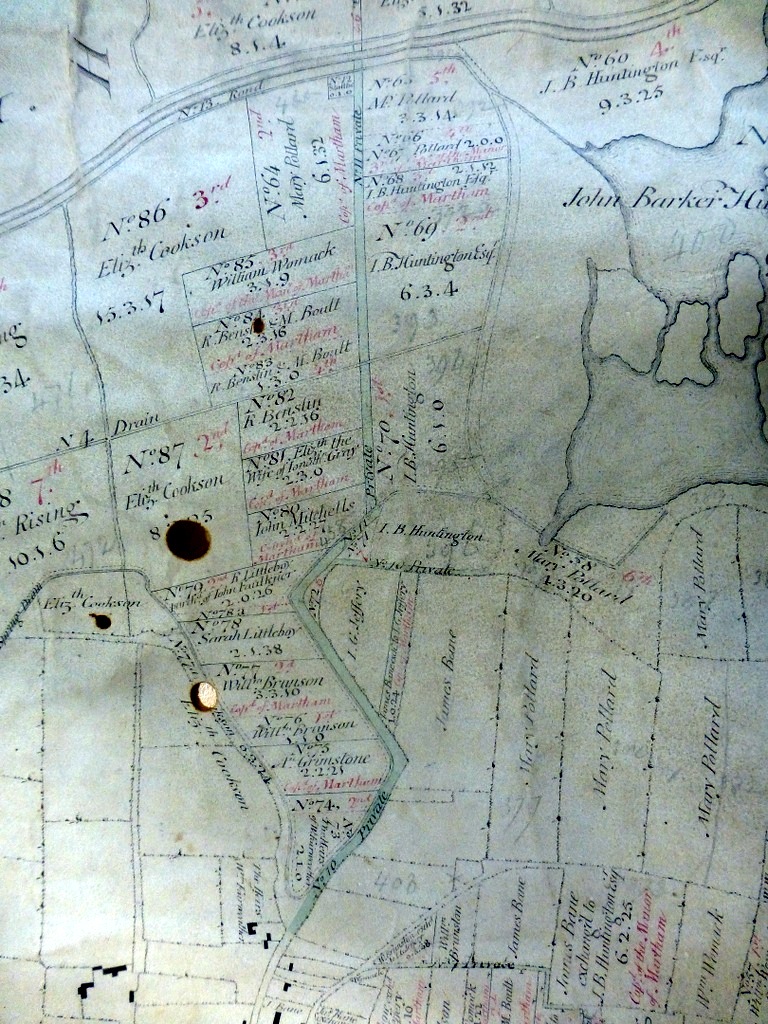
History: This footpath was only officially added to the definitive list of Martham footpaths by Norfolk County Council in 2021 and yet its roots can be traced back over 210 years. In 1812 the exact same route was shown on the Martham Inclosure Award and designated as Private Road Nos10 & No11. The Award said these roads were for the “use and convenience of the owners and occupiers of land lying in the said parish of Martham” and “as access to public staithe No12”. The roads are shown in green on the 1812 Inclosure Award map illustrated below. You will also notice on the map that the footpath crosses Drain No4 on the map. This drain was ordered to be built by the Inclosure Award Commissioners in 1812 as one of several for the purpose of draining the marshes and extending productive farming of dryer land.
Start: The footpath starts at grid reference TG 4565 1922 where the U69349 road runs out at the extreme north end of Damgate Lane and runs generally in a northerly direction. There is very little room for parking so please take care not to block the farmyard and field entrances.
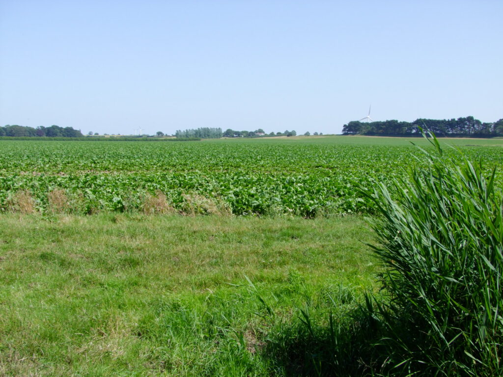
To begin with the footpath consists of a farm track about 2.8 metres wide. It is generally dry at this point but further on a steadily deteriorating surface can have huge puddles in poorer weather conditions and depending on the time of year. To your left (west) are meadows, paddocks and mature trees where the original marshes have completely dried out. To your right (east) are open fields that gently rise giving distant views of Flegg High School and the wind turbines at West Somerton.
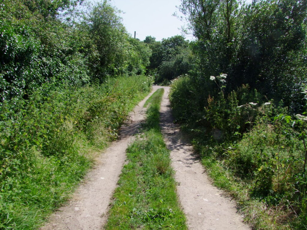
The cart track meanders a little and after about 268 metres ends at a field on the right whilst the footpath goes north westerly at TG 4569 1948. There are no waymarkers on this path so generally head north between the trees and not across open fields.
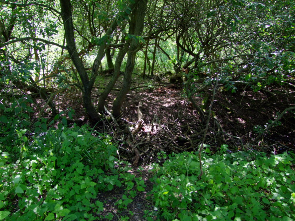
The path continues to gently meander and narrows for about another 262 metres to TG 4548 1963 whilst on your left is boggy waterlogged Alder Carr (see below). Soon after this look left and you will see Drain No4 as mentioned above and it still works to help drain the marshes to this day.
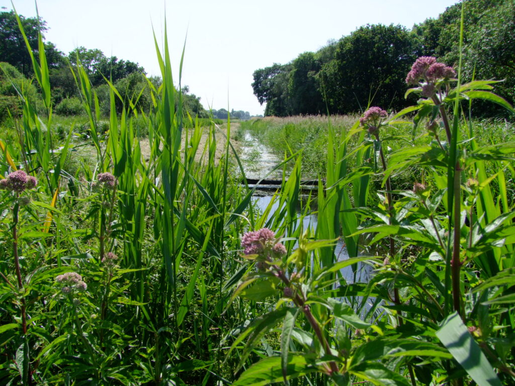
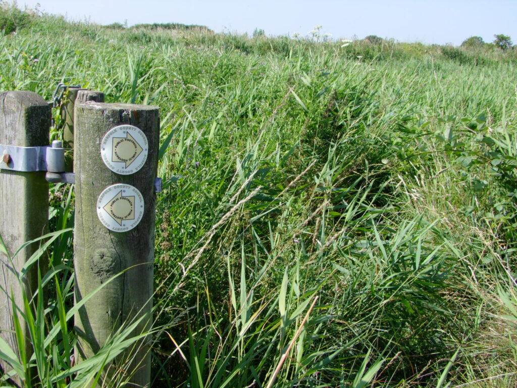
The path has become a single track by the time it reaches TG 4552 1975 and marsh reed takes over providing wide sky vistas and the first glimpses of the River Thurne. During the summer growing season the narrow path can be completely overgrown and very uneven along this stretch. After approximately 600 metres the path ends at a waymarker that points out Footpath No2 both east and west.
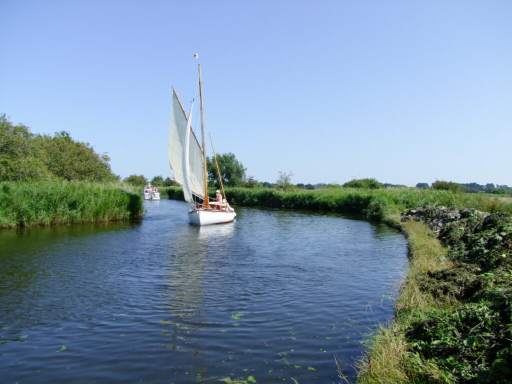
A short detour is recommended at this point to the east along Footpath No2 skirting the delightful River Thurne for a couple of hundred metres to Dungeon Corner which as its name suggests provides a challenging chicane bend for river traffic.
Having reached the river, you can now re-trace your footsteps back the way you came or head east along Footpath No2 and then up Ferrygate and across Footpath No4 via Moregrove and back to Damgate. A longer walk would be to follow Footpath No2 round Martham Broad and on to West Somerton, through the village and back to Damgate via Footpath No3.
For a printer friendly version click HERE. This will open a separate window as a ‘pdf’ that you can then print.