Black Street, Martham
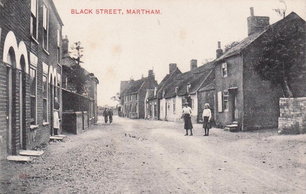
Black Street is one of the oldest streets in Martham linking the village centre and Ferrygate as the route from The Green to the river. In the 1812 Inclosure Award it was listed as one of the five King’s Highways entering Martham Green (the others being what we now know as Rollesby Road, Repps Road, White Street and Hemsby Road).
Before the 1900’s the street had properties at The Green end and near the church but nothing in between except fields.
During the early 20th century it was called Church Street but not consistently – there is a mixture of the two names in the 1911 census. Some post cards of the same period call it Church Street as does the 1939 Register.

Local people say that Black Street was for funerals going to St Mary’s whereas White Street was for weddings.
Long since demolished Providence Place was a small courtyard of poor quality houses just off Black Street accessed by a passage between what is now No 24 and the Oddfellows Hall.
In November 1892 an influenza outbreak in Flegg laid many low. There was also an outbreak of typhoid fever in Martham in the autumn of 1894 which had much to do with the poor state of the drains particularly in Black Street which were insufficient to carry the sewage away. Both kept Dr. Anthony Crisp the village doctor and apothecary, who lived at The Jasmines on Staithe Road, particularly busy.
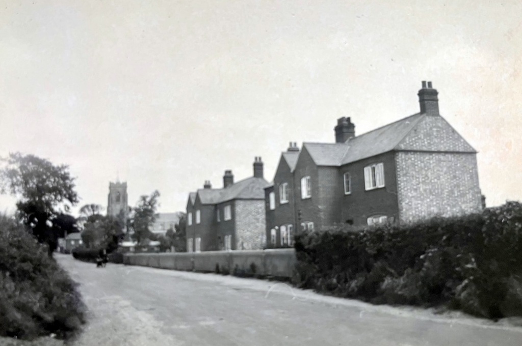
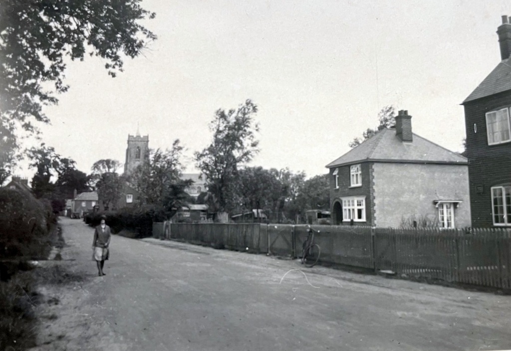
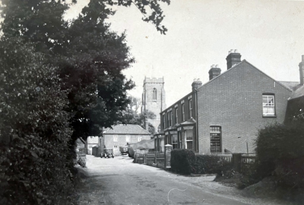
The series of photos shown above were taken Ivy Cossey (1911-2000) in around 1925. They are taken looking north along Black Street towards the Church.
The map below has markers highlighting points of interest along Black Street. Hover your mouse over a marker to get a description of the building or place. Click the marker and you will be taken to a new page giving details of the building or place if it is available. You can zoom in or out of the map or click and drag it to a new position.
See also the page entitled Stone Houses.
Photographs
Click a thumbnail for a close-up and scroll through all the images from there.


")


