Hemsby Road, Martham
Hemsby Road is one of the oldest streets in Martham providing access to the village from the east. In the 1812 Inclosure Award it was listed as one of the five King’s Highways entering Martham Green (the others being what we now know as Rollesby Road, Repps Road, Black Street and White Street).
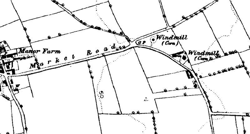
Hemsby Road was called Market Road for some time between 1840 and perhaps as long as 1950 but this is uncertain. Ordnance Survey maps like the one below support this naming, but other sources do not. The 1841 census calls it Hemsby Lane. The 1851 census is the only one that actually calls it Market Road. The 1861 census calls it Hemsby Road, whilst it is not named at all in the 1871 census. In 1881 it was listed as Yarmouth Road. From the 1901 census onwards, it is called Hemsby Road. The census forms are more likely to reflect local knowledge than the maps, which are said to be revised from time to time are obviously less accurate.
You can also see from this map that there were two windmills in Hemsby Road. They were there for over 100 years and you can read more about them by clicking HERE.
There are some historic houses and buildings connected with Hemsby Road that you may like to read about.
One was Point House which has long since disappeared -click on its name to see more about it.
Another house of interest is the listed building called Gables Farm which still exits.
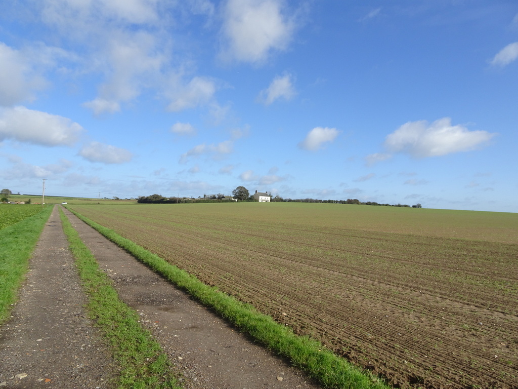
Mill Farm House stands on the other side of the road from where the windmills once stood.
Next door to Mill Farm House is Mill Barn that was once associated with the windmills.
Gibbet Hill
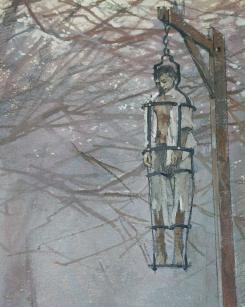
It is claimed that in about 1805 a gibbet stood at the far east end of Hemsby Road on the parish boundary with Somerton. The area has been known as Gibbet Hill ever since. Technically in the parish of Somerton it has always been attributed to Martham because it is said a man was gibbeted there after he burnt down half of Martham. It is not unusual for gibbets to be placed on high ground near to roads on a parish boundary so that passers by would see the suspended criminal thus giving out the message that the authorities of the village upheld law and order.
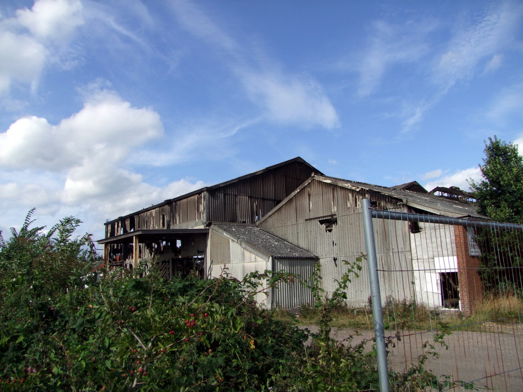
MELPAC
MELPAC had a frozen food factory on the north side of Hemsby Road on the opposite side of the road from the Doctors Surgery in the 1970’s and 1980’s. It also had a frozen food outlet in a small unit there. It closed in the 1990’s and a dramatic fire destroyed the buildings in August 2009.

Development site
Planning permission was granted for land on the north side of Hemsby Road part of which was formally occupied by MELPAC and the building of houses took place in 2024. In the past the land was quarried for clay to make Martham bricks in the 19th century and consequently an archaeological survey was carried out, as part of the planning application process, by Archeological Services Ltd, Shefford, Bedfordshire. The survey provides some interesting references to historical facts for the village and can be seen HERE.
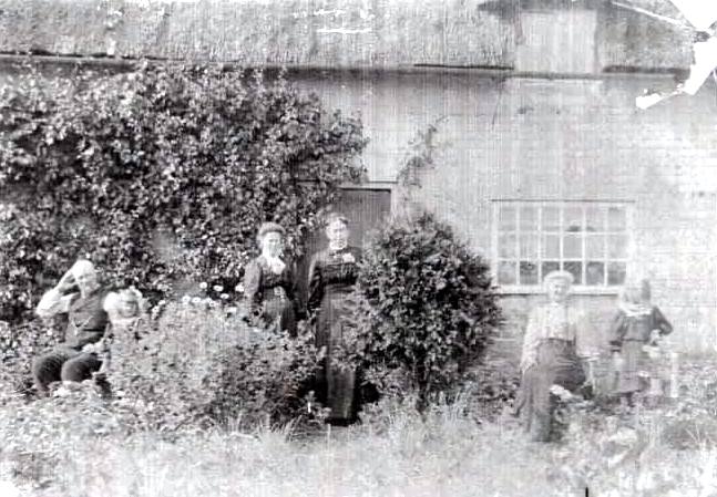
Photographs
Click a thumbnail for a close-up and scroll through all the images from there.


