Footpaths 7, 8 & 9 Martham 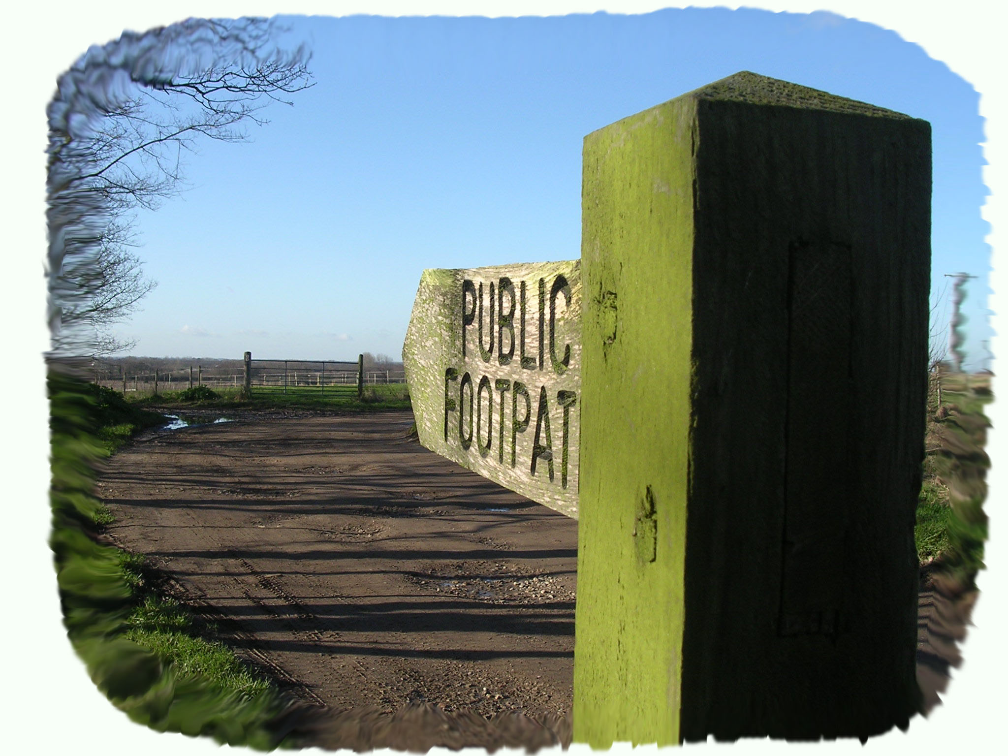
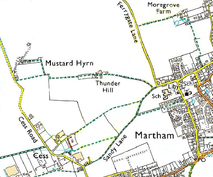
Footpath Nos 7, 8 & 9. All three run through the west field system. Nos 7 & 9 start part way along Sandy Lane.
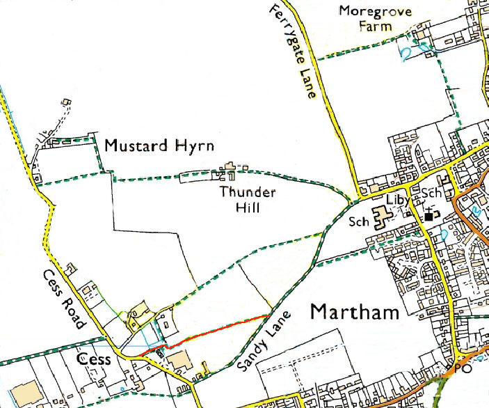
No 7 runs for 502 yards (470 metres) from OS map ref: TG449181 to TG445179
No 8 is just a short shingle-based path that links 7 & 9.
No 9 runs for 715 yards (669 metres) from OS map ref: TG451184 to TG445181
Surface: No7 is a grass track beside fields. No9 runs through a cropped field for the most part but the route is normally clearly marked by regular walkers.
Linked Footpaths: Both paths join No17 (Sandy Lane) and are part of the interconnected group of footpath numbers 5, 6, 7, 8, 9, 10, 13, 14, 15, 17 & 18 that are the remains of medieval paths running from the church to the 13th century hamlet of Cess and provided access to the west field system.

The whole of the west field land usage history at Martham derives from the high number of freemen who owned strips of land in the area. These strips were called furlongs and were passed down through families on death and split into smaller and smaller lengths as both sons and daughters inherited the land. Each furlong would have only been separated by a narrow grass path, but many were required to provide access. Furlongs became known as ‘wongs’ and even today local folk will refer to footpaths 7, 9, 17 and even No6 has going over the ‘wongs’.
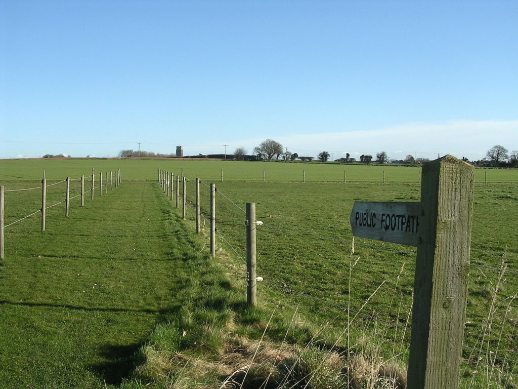
Start for No9: Starting from the Cess Road end you can park at the footpath sign just past Martham Boat Yard Company. The walk beside the graveyard of riverboats and within a few yards passes old greenhouses and to the side of a locked double gate. Carry on regardless and on your left is footpath No8* if needed. The photo on the right shows the start of footpath No9 looking east.
At the north end of footpath No8 at TG445182 a ‘Town House’ once stood to house paupers. It was used until about 1777 when the ‘House of Industry’ (Workhouse) was opened at nearby Rollesby and Martham paupers were housed there.
Footpath No9 skirts to the left of a residential caravan and heads west in a few short steps to the open fields. Seen from this approach the sunlight almost always indicates the well trodden path even when early cropped. A walk of 323 yards takes you across the field to the junction with Footpath No 17 at Sandy Lane. As you cross the field take a moment to appreciate the wide Broadland views north across to Thunder Hill which is part of Footpath No6.
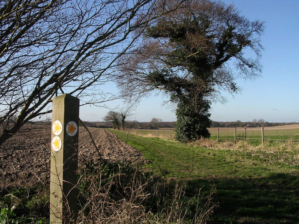
Start for No7: A little further along Cess Road from the Martham Boat Yard Company there is a turning on the right called Cess Lane that is a cul-de-sac. At the end of it starts footpaths No7 and No8. Alternatively start at the Cess Road end of No9 and walk the short length of No8 to path No7. The walk starts on a mown path for only a few yards and then crosses an open field. At the second field the path turns into a more permanent track to the left of the field until once again it joins with Footpath No17. The photo on the left is looking back over the ‘wongs’ towards Cess.
Cess Road provides access to footpaths 1, 2, 5, 6, 7, 8, 9, 13 and 17 at various points.
For a printer friendly version click HERE. This will open a separate window as a ‘pdf’ that you can then print.