School Road, Martham
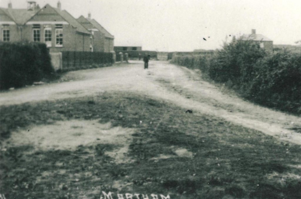
Above -School Road, looking north from Somerton Road circa 1930. No pavements, no street lights, no properties on the east side and a grass triangle at the junction of the road with Somerton Road. The field boundary hedges on the right are mostly still in place to the front gardens of the properties.
The photograph shown above has the former first school on the left and allotments on the right, or the east side. The allotments were sold for housing in 1971 to Harvey Builders (East Anglia) Ltd. They purchased the whole of the former allotments from the Registrar of the Diocese of Norwich. It had been Ecclesiastical land and the representative of the Church Commissioners for England that signed it over was Rev. Ronald Cooling who had been the Registrar since July 1955. Harvey Builders paid £10,700 for the whole of the 1.344 acres of land. The deeds refer to School Road as originally being part of White Street.
Interestingly, and probably because it was previously Ecclesiastical land, the deeds held by the new freeholders said they could not run a place of amusement, hotel, tavern, inn or public house, nor could they brew liquors at any time.
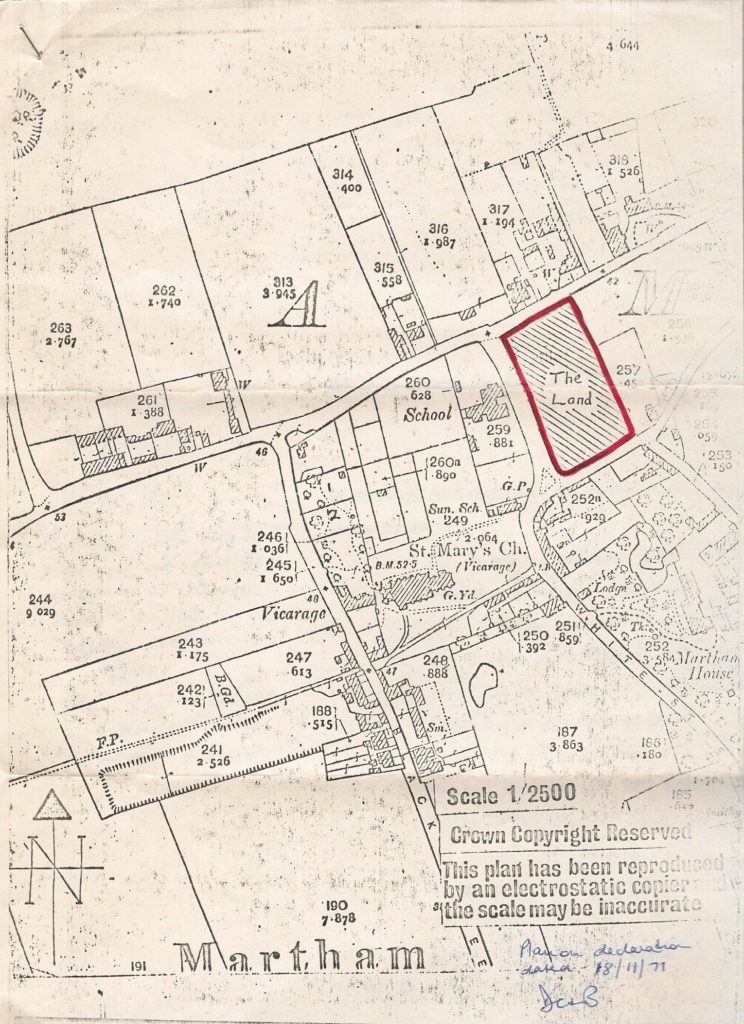
The attached plan shows the plot plus other historical points of interest. Note the clear position of the long lost Martham House, its entrance off White Street and its Lodge. The old Church Hall is marked Sunday School plot 249. Plot No259 is the former First School built in 1878/79 and demolished in 2013. Baileys Nursery area only has Bell Meadow pond in the corner near the church. What is now Oak Tree Close is only a pit formally a clay quarry (for brickmaking). The Vicarage stables are on what is now St Mary’s Church car park. Thurne Rise does not exist. The plan is dated 1971 but is clearly based on an earlier map possibly as far back as 1842.