Footpath No21, Martham 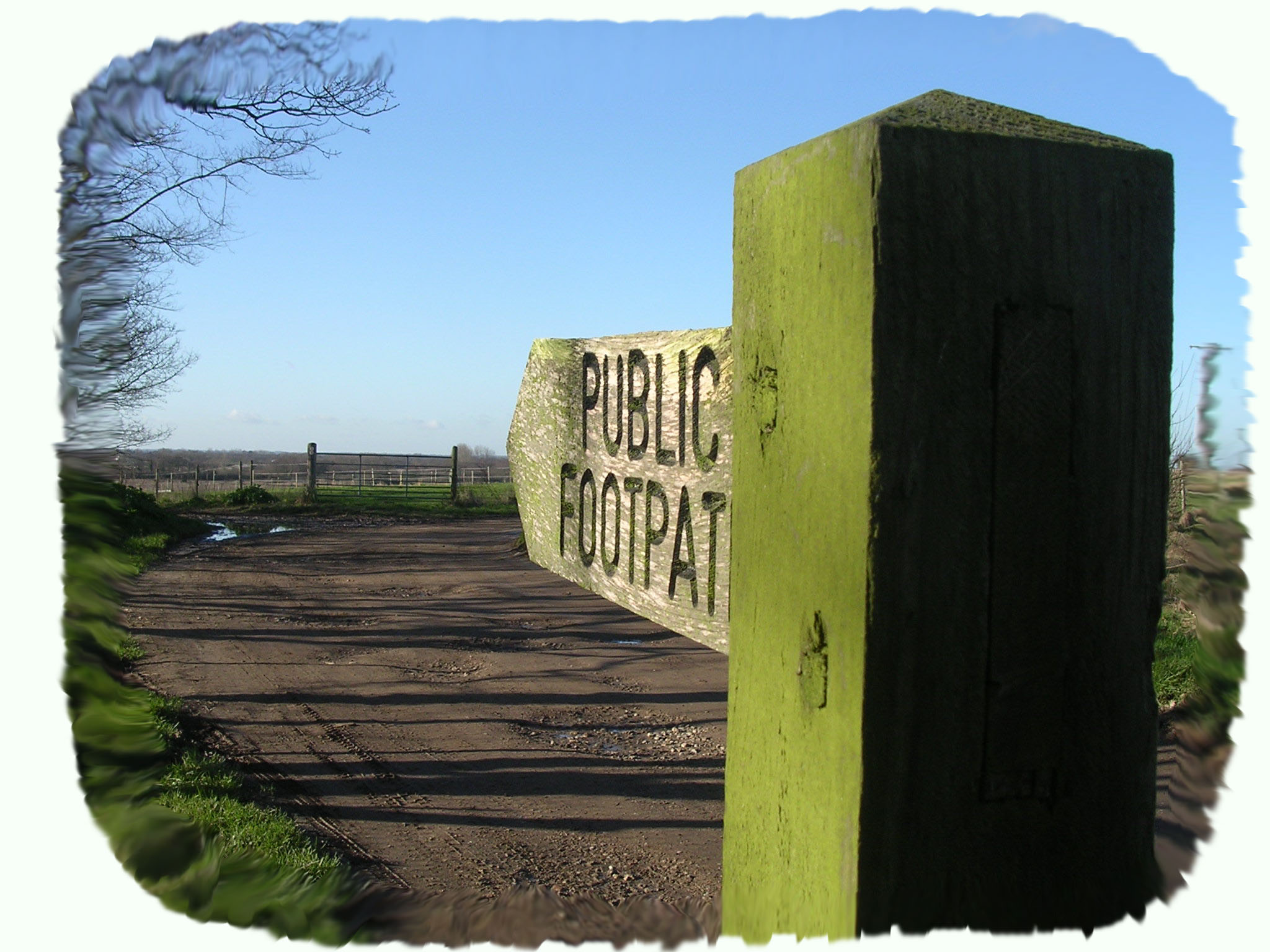
Footpath No21: Runs from Somerton Road, Top Farm on the B1152 to Hemsby Road, Gibbet Hill Farm. Sometimes known locally as Mill Lane.
OS map ref: TG466192 to TG473178. Distance: 1795 yards (1641 metres).
Surface: Typical farm cart track mainly firm unless the weather has been atrocious in which case muddy in parts. Steadily getting overgrown and reducing itself to a single path but still passable for tractors.
Description: Straight lane conveniently joining two of the roads from the east into Martham with clear views across typically open Norfolk fields.
Linked Footpaths: At its north end a short walk from the end of footpath No2 and footpath No19 at the bottom of Gibbet Hill, Hemsby Road.
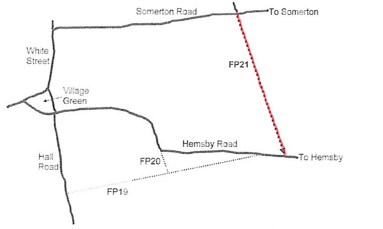
Start: Park with care at the farmyard opposite Top Farm on the B1152 where a double gate shuts off the path but has a stile on its left as you look south at TG466192
The path is arrow straight for 1,795 yards with few characteristics of its own other than those wonderful big skies so typical of Norfolk. As you walk south there are clear views of Martham to the west. The east side of the path is the parish boundary between Martham and Somerton and the most obvious major features are the modern wind turbines that are actually situated in West Somerton.
The area to the east of the footpath, again in Somerton, is known as Blood Hills. The colourful local explanation says the name derives from a bloody battle that took place in the 13th century between the Saxons and the Danes but sadly there has been no archaeological or historical evidence to support this. A more prosaic explanation derives from the 1300’s Danish landowners name of ‘Bloduelle’ and if you say it fast enough it soon turns it into Blood Hills.
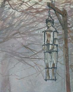
Martham Gibbet was said to stand at the top of the rise to the east of Gibbet Hill Farm which is near where the path comes to an end at Hemsby Road. The ‘General History of the County of Norfolk’ published in 1829 says that a person was executed for setting fire to part of Martham and was hung on a gibbet. It was normal practice to position gibbets in a prominent position on the boundary of a parish where the decaying body would be seen by those passing by and act as a deterrent to wrongdoers.
The name ‘Mill Lane’ is curious because it is nowhere near either the former Martham or Hemsby windmills and Somerton did not have a windmill. It is possible it was part of the route to either Martham or Hemsby mills. The lane is listed in the 1812 Inclosure Award for Martham as ‘Private Road No1’.
There is nowhere convenient to park at the Gibbet Hill end of footpath No21 and care should be taken on the busy road there.
For a printer friendly version click HERE. This will open a separate window as a ‘pdf’ that you can then print.