Sco – lost hamlet of Martham
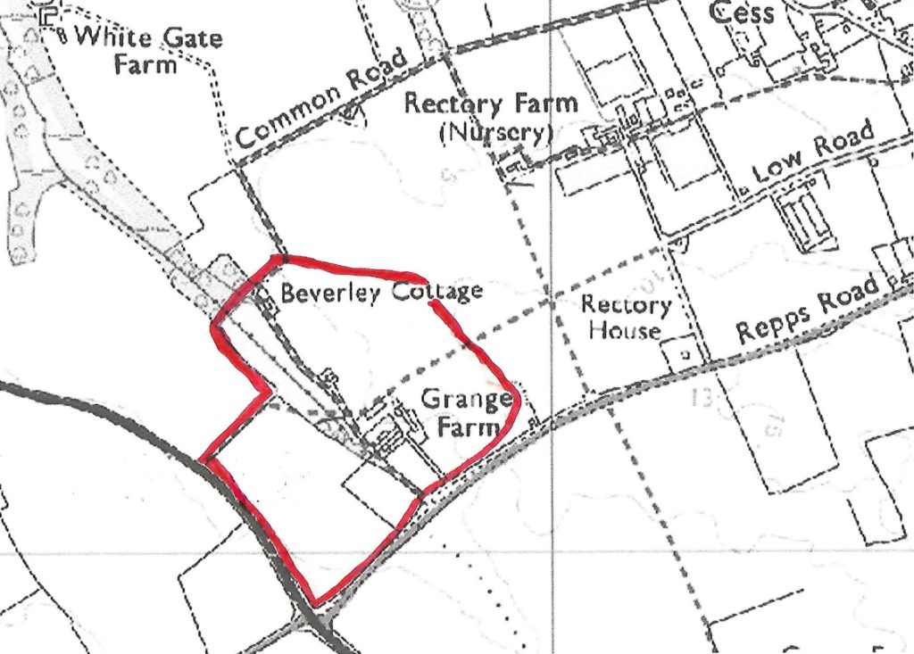
Sco, a word meaning wood, was once a hamlet in the area around what is now Grange Farm but it was so small it never became an ecclesiastical parish. The above map shows what would have been its likely location.
At the time of the Domesday survey in 1086 it was listed as a separate place but with only one freeman and two boarders.
In a survey carried out by Walter De Kirkby, Prior of Norwich, in 1273 Sco field was mentioned as adjoining Martham field. The north field of Sco was also mentioned as was the King’s Highway from Sco to Repps and the King’s Highway leading from Sco to Martham. A family took its name from it; Alexander De Sco was living there in 1273 and held lands there.
The very detailed Stowe Survey(1) carried out in 1292 by the Norwich Cathedral Priory included land it held at Martham and leaves no doubt that Sco was a hamlet lying between Martham and Repps. It included about twelve dwellings and at least eighteen tenants of Martham Manor who held land in the Sco fields.
At the end of the 13th century Roger De Hil had three and three-quarter acres of land at Sco but his ancestors must have had declining fortunes because by 1334 Taxpayer returns showed Sco had been deserted.
Now the name Sco is forgotten although there remains a scatter of cottages along Common Road which was the old route for taking cattle from Sco to the open, shared pastureland of the dry common.
(1) British Library Stowe MS 936. A Terrier of the Norwich Priory estates 1292. Microfilm in the Norfolk Record Office. MP 514.